Balloons Debrief posted in balloons
April 15, 2016
I’ve wanted to make this post for a while, but life and finals got in the way. I finally found the time to write this up, exactly a month after the balloon launch.
First of all, thank you to everyone that contributed to this mission. We couldn’t have done it without you all.
Flight Details
The balloon was launched on April 16th, 2016 just before 4pm EST near Prattsville, NY. We had initially planned for the launch to be before noon to make recovery easier, but delays and technical issues pushed the launch time back.
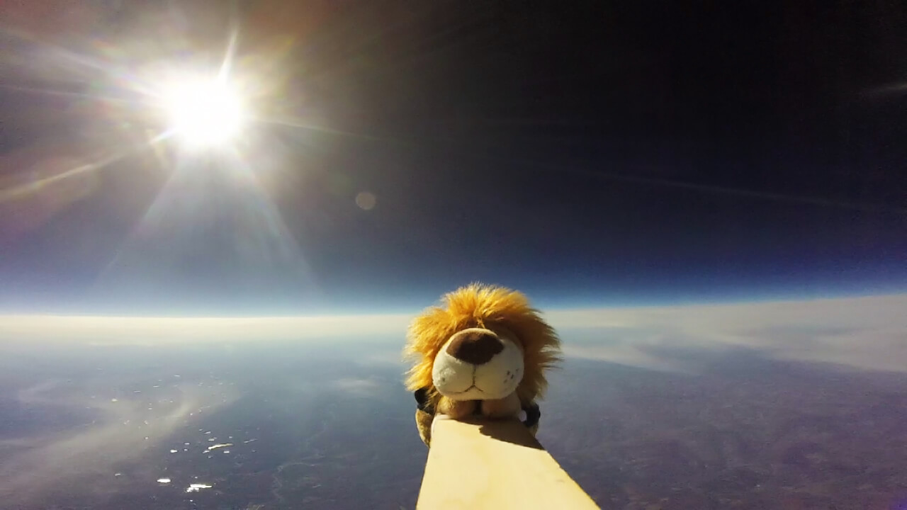
Over the course of almost three hours, the balloon rose at a rate of 5 m/s or ~16 ft/s, reaching a peak of 32948.88m or 108100ft at about 6pm EST.
The balloon landed in the backyard of a farm house around 6:44pm. It landed in the middle of a lawn right next to a road, resulting in a very easy recovery. We were very grateful for this, as by the time we reached the payload it had gotten dark. Landing in a more difficult location would have required recovery on a different day.
The maximum altitude of our balloon is rank 88 on arhab.org
Launch Notes
Having multiple possible launch locations was crucial - launch sites became unavailable due to weather and logistics changes.
We need a smaller tank for helium transportation. We had to rent a van to carry the large tank, which was an inefficient use of funds as it could only carry 2 people. Using two smaller tanks would allow us to carry them in an SUV, which can fit more people.
I thought the APRS GPS tracker (the radio one) wasn’t working because it wasn’t showing up on the website. However, I was able to verify with my Baofeng UV-5R and APRSdroid’s packet decoder that the radio was, in fact, working. I later determined that, because we were launching in the mountains, the radio signals weren’t getting to the nearest repeater. The balloon showed up on the website shortly after launch.
The ground winds were absolutely brutal for the launch. Considering it was the first launch for most of our crew, they handled it remarkably well. The winds finally died down towards the end, enough for us to get a clean launch.
Since we didn’t have a mass flow meter to measure the amount of helium (we were quoted $2500 for one from Alicat), we had to use a scale to determine the lift force. A cheap luggage scale/fish scale worked well enough to ensure we didn’t underfill the balloon, but by launch we had to wing it to catch the break in surface wind.
The SPOT GPS tracker we had worked for going up (under the altitude limit) and showed up a couple times during the descent but didn’t work for the landing. This is interesting, especially since it’s usually the radio that doesn’t survive the landing.
We accidentally taped over the ozone sensor poking out of the box - this is my fault for not familiarizing the crew with the equipment and payloads; I might have even taped over it myself. We still collected data, but I’m not sure how accurate or reliable it is.
We need to launch much earlier next time ensure we can recover before sunset. This will get better with more preparation and experience.
The GoPro battery ran out early (we had the cheapest model) so we only got footage up to ~70,000 ft. We’re looking into acquiring a better GoPro along with a battery backpack.
Results
We will start going through the data more thoroughly now, especially with more time in the summer. We’ll post any results or findings here.
BWOG wrote an article about us! Read it here
We released our Youtube video of the launch, watch it here
The Columbia University Facebook page wrote a post about us, read it here
The Future
With a successful launch under our belt, we can look forward to doing more exciting and ambitious things!
We need to start looking for additional funding and future mission objectives. If you have any suggestions, please feel free to contact us through email or social media.
Thanks, Jake Lee
Liked that post? Check out the news page